


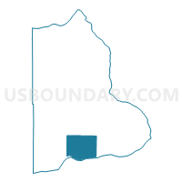
Paterson Voting District, Benton County, Washington
About
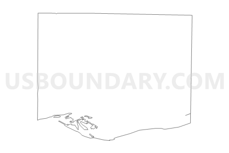
Outline

Summary
| Unique Area Identifier | 683503 |
| Name | Paterson Voting District |
| County | Benton County |
| State | Washington |
| Area (square miles) | 92.09 |
| Land Area (square miles) | 92.09 |
| Water Area (square miles) | 0.00 |
| % of Land Area | 100.00 |
| % of Water Area | 0.00 |
| Latitude of the Internal Point | 45.98256320 |
| Longtitude of the Internal Point | -119.48592820 |
Maps

Graphs
Select a template below for downloading or customizing gragh for Paterson Voting District, Benton County, Washington


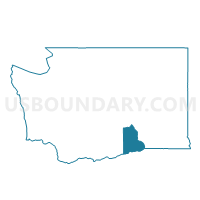
Neighbors
Neighoring Voting District (by Name) Neighboring Voting District on the Map
- Carley Voting District, Benton County, WA
- Expansion Voting District, Benton County, WA
- Reese Voting District, Benton County, WA
- Water: Columbia River, Benton County, WA
- Wellington Voting District, Benton County, WA
Top 10 Neighboring County Subdivision (by Population) Neighboring County Subdivision on the Map
Top 10 Neighboring Unified School District (by Population) Neighboring Unified School District on the Map
- Kennewick School District, WA (85,577)
- Prosser School District, WA (12,996)
- Paterson School District, WA (451)